


Wicksburg, Houston County, Alabama
About
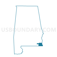
Outline

Summary
| Unique Area Identifier | 521926 |
| Name | Wicksburg |
| County | Houston County |
| State | Alabama |
| Area (square miles) | 36.45 |
| Land Area (square miles) | 36.43 |
| Water Area (square miles) | 0.02 |
| % of Land Area | 99.95 |
| % of Water Area | 0.05 |
| Latitude of the Internal Point | 31.23495620 |
| Longtitude of the Internal Point | -85.62526610 |
Maps


Graphs
Select a template below for downloading or customizing gragh for Wicksburg, Houston County, Alabama


Neighbors
Neighoring Voting District (by Name) Neighboring Voting District on the Map
- Bay Springs, Houston County, AL
- Bellwood-Chancellor, Geneva County, AL
- Clayhatchee, Dale County, AL
- Dundee-Hurricane Creek-Sardis Voting District, Geneva County, AL
- Hartford NG Armory-St. Paul, Geneva County, AL
- Malvery-Hughes Voting House, Geneva County, AL
- Newton, Dale County, AL
- Pinckard, Dale County, AL
- Tate-Slocomb Community Room, Geneva County, AL
Top 10 Neighboring County Subdivision (by Population) Neighboring County Subdivision on the Map
- Dothan CCD, Houston County, AL (84,863)
- Daleville CCD, Dale County, AL (11,976)
- Newton-Midland City CCD, Dale County, AL (9,526)
- Slocomb CCD, Geneva County, AL (8,050)
- Bellwood-Coffee Springs CCD, Geneva County, AL (2,323)
Top 10 Neighboring Unified School District (by Population) Neighboring Unified School District on the Map
- Houston County School District, AL (36,943)
- Geneva County School District, AL (20,500)
- Dale County School District, AL (15,572)
- Daleville City School District, AL (11,560)
Top 10 Neighboring State Legislative District Lower Chamber (by Population) Neighboring State Legislative District Lower Chamber on the Map
Top 10 Neighboring State Legislative District Upper Chamber (by Population) Neighboring State Legislative District Upper Chamber on the Map
Top 10 Neighboring 111th Congressional District (by Population) Neighboring 111th Congressional District on the Map
Top 10 Neighboring Census Tract (by Population) Neighboring Census Tract on the Map
- Census Tract 401, Houston County, AL (4,949)
- Census Tract 505, Geneva County, AL (4,288)
- Census Tract 213, Dale County, AL (4,034)
- Census Tract 212, Dale County, AL (2,696)
- Census Tract 502, Geneva County, AL (2,323)